I love Google Maps, but it sucks for hiking — here's the app I use to avoid getting lost in the woods
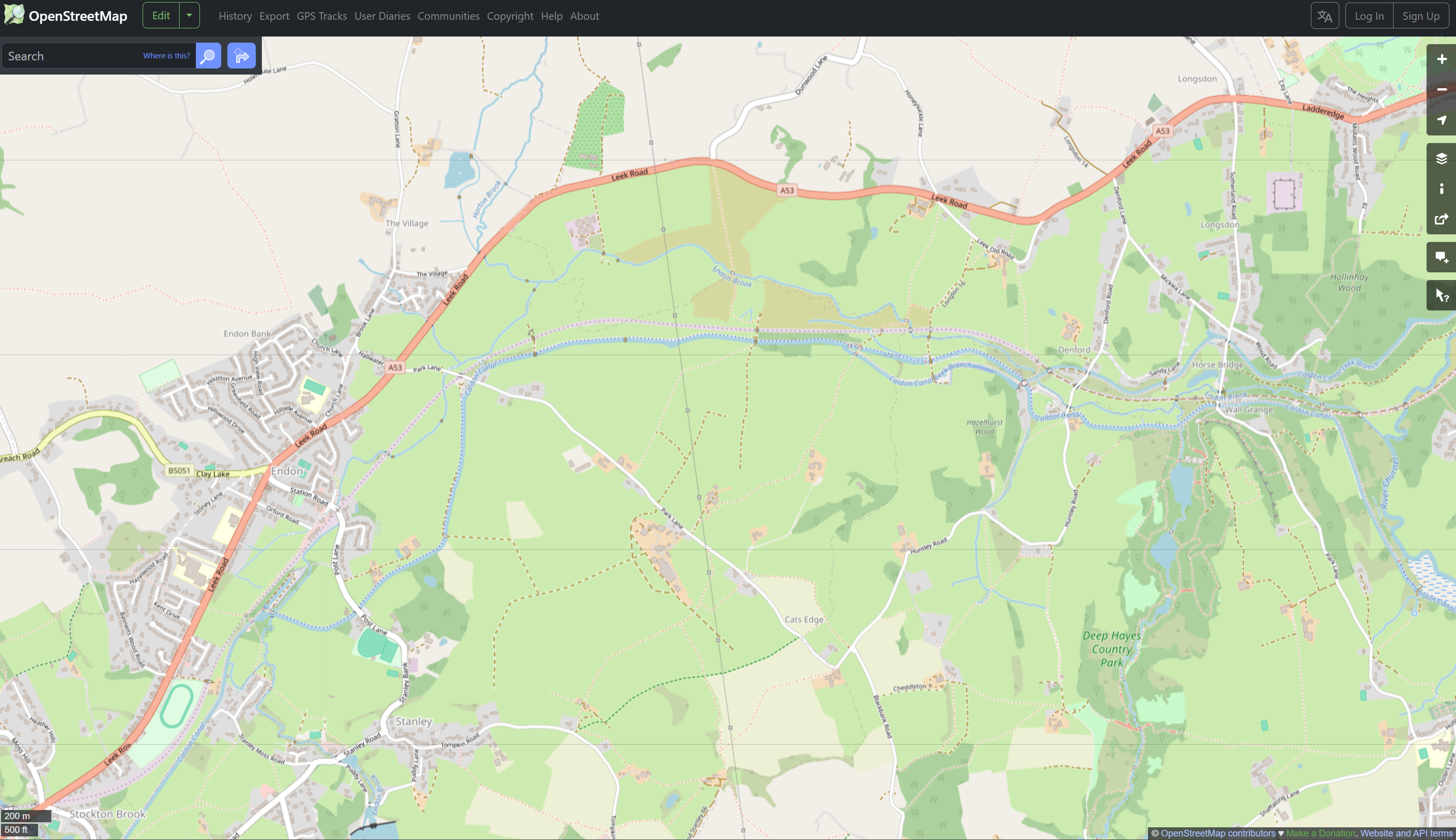
OpenStreetMap is free, and much better at mapping trails than Google

I use Google Maps a lot, even when I don't actually need it. There's so much on offer in Google's navigation app, and so far I haven't been able to find an alternative that doesn't infuriate me when out on the road. But Google Maps is far from perfect, and as good as it is on the road, I've found it's absolutely useless off it.
I have two Labradors who need a lot of exercise and love to explore new areas. So I tend to do a lot of hiking and rambling through the nearby countryside to tire them out. Finding new footpaths and trails with Google Maps is a pretty miserable experience, because it has next to no information about them. So I've found a useful (and free) alternative in the form of Open Street Map.
Google Maps needs more hiking trails
The first thing I should mention is that I know Apple Maps launched its own hiking features last year, alongside iOS 18. But I'm primarily an Android user, and switching to an iPhone just to go hiking would be a huge pain in my proverbial neck. Unfortunately, that is one feature Google Maps doesn't have, and hasn't yet copied, which is finding new trails quite difficult.
Admittedly, I have spent a great deal of my time just following paths in the woods to see where they go. There are plenty of them, and as the winter months draw closer, they're a lot easier to spot and walk through. Considering I live in a country that lacks any large predators or particularly extreme weather, there's very little to lose by wandering around and seeing where you end up.
The most dangerous thing around, aside from the occasional gang of loud teenagers, is probably the wild blackberry bushes. Those barbs may not be lethal, but they are quite painful.
Still wandering down those random paths has led me to a dead end more times than I can count, and it's very frustrating to have to turn back and figure out where I went wrong. I've found it's always a good idea to have a rough indication of where to go, even if your map isn't quite accurate.
Since Google Maps can't help me with this, I've found OpenStreetMap to be a fairly useful alternative. Imperfect, but good enough.
Get instant access to breaking news, the hottest reviews, great deals and helpful tips.
OpenStreetMap is detailed, and free

I live in the U.K., and anyone who's ever gone on any kind of excursion into the country knows there's one map company that's a cut above the rest: Ordnance Survey. They are easily the most detailed and high-quality maps of the British Isles you can find, but there's a process to go through to get those maps on your phone.
There is a free version, but you have to go through the process of signing up, learning how everything works, and being pestered to subscribe to the more feature-rich premium version. Honestly, it's a process I can do without, and it's why I like OpenStreetMap so much. Along with the fact that it has maps for the entire planet, not just the U.K.
It is probably the closest thing we have to a Wikipedia for maps. It's open source, free to use, and built on user and community knowledge. Better still, the free use aspect means developers have been able to use their mapping data in their own navigation apps. So while OpenStreetMap itself may have a very boring map company interface, various apps have adapted it to be more familiar to the legions of Google Maps users around the world.
Personally, I've been a fan of OsmAnd (available on Android and iOS), which stores all its maps offline. It is not the kind of app I'd use when navigating by car, but it retains enough useful features to help me walk around the nearby countryside without issue. Aided by the fact that it has all the same off-road routes and trails as OpenStreetMap. It does still ask you to pay money, though, but at least it doesn't bombard you with ads if you don't.
And I've never had an issue with the walking trails the OpenStreetMap data has offered up. Aside from the time I mistook a power line for a public footpath, and got accosted by the manager of my local golf course. I won't be making that mistake again.
Bottom line

Maybe there are better ways for me to uncover new walking trails, without walking into a bunch of plants hell-bent on stabbing me. There really is no shortage of options if you need hiking apps, especially if you're over in the U.S. rather than the U.K. But your classic navigation apps aren't really among them, and that needs to change. Especially for Google, since Apple already jumped on this particular bandwagon last year.
But hey, you don't necessarily need to pay or relearn your map-reading skill to find places to walk — especially if you're just a casual walker like me. There's always OpenStreetMap to show where you need to go, and whether that trail you're on is actually going to get you where you need to go.
Follow Tom's Guide on Google News and add us as a preferred source to get our up-to-date news, analysis, and reviews in your feeds. Make sure to click the Follow button!
More from Tom's Guide
- Google Maps could be about to change how you add stops mid-drive — and this is why it'll make your life harder
- Tired of Google Maps and Apple Maps? Here are your best alternatives
- Does charging overnight damage your phone battery? 3 features that stop it happening

Tom is the Tom's Guide's UK Phones Editor, tackling the latest smartphone news and vocally expressing his opinions about upcoming features or changes. It's long way from his days as editor of Gizmodo UK, when pretty much everything was on the table. He’s usually found trying to squeeze another giant Lego set onto the shelf, draining very large cups of coffee, or complaining about how terrible his Smart TV is.
You must confirm your public display name before commenting
Please logout and then login again, you will then be prompted to enter your display name.
 Club Benefits


