I discovered the one thing Apple Maps really needs to fix
Finding hiking trails in Maps is hit or miss — and mostly miss

Here at Tom’s Guide our expert editors are committed to bringing you the best news, reviews and guides to help you stay informed and ahead of the curve!
You are now subscribed
Your newsletter sign-up was successful
Want to add more newsletters?

Daily (Mon-Sun)
Tom's Guide Daily
Sign up to get the latest updates on all of your favorite content! From cutting-edge tech news and the hottest streaming buzz to unbeatable deals on the best products and in-depth reviews, we’ve got you covered.

Weekly on Thursday
Tom's AI Guide
Be AI savvy with your weekly newsletter summing up all the biggest AI news you need to know. Plus, analysis from our AI editor and tips on how to use the latest AI tools!

Weekly on Friday
Tom's iGuide
Unlock the vast world of Apple news straight to your inbox. With coverage on everything from exciting product launches to essential software updates, this is your go-to source for the latest updates on all the best Apple content.

Weekly on Monday
Tom's Streaming Guide
Our weekly newsletter is expertly crafted to immerse you in the world of streaming. Stay updated on the latest releases and our top recommendations across your favorite streaming platforms.
Join the club
Get full access to premium articles, exclusive features and a growing list of member rewards.
More often than not, Apple Maps gets a bum rap. Yes, the move away from Google-supplied maps to Apple's own data a decade ago was a self-inflicted error that set back Apple's mapping software by years.
But each subsequent update since iOS 6 has righted a lot of wrongs. The iOS 15 version of Maps is an especially strong effort, introducing a number of enhancements and improvements, even if Google's offering still wins our Google Maps vs. Apple Maps showdown.
Even with those improvements, Apple Maps still has moments where it can lead you astray. And there's one area in particular that I'd like to see Apple tackle.
I like to hike in my spare time, and I'm fortunate that while I live in a fairly urban area, I'm just a short drive away from a variety of hills, wooded areas and other primo hiking spots that let me get some fresh air and a little bit of fitness into my routine. Or, more accurately, I would be a short drive away if Apple Maps could get me to trailheads with anything approaching consistency.
One time, searching for a trailhead, Apple Maps directed me to the driveway of a rather perplexed homeowner.
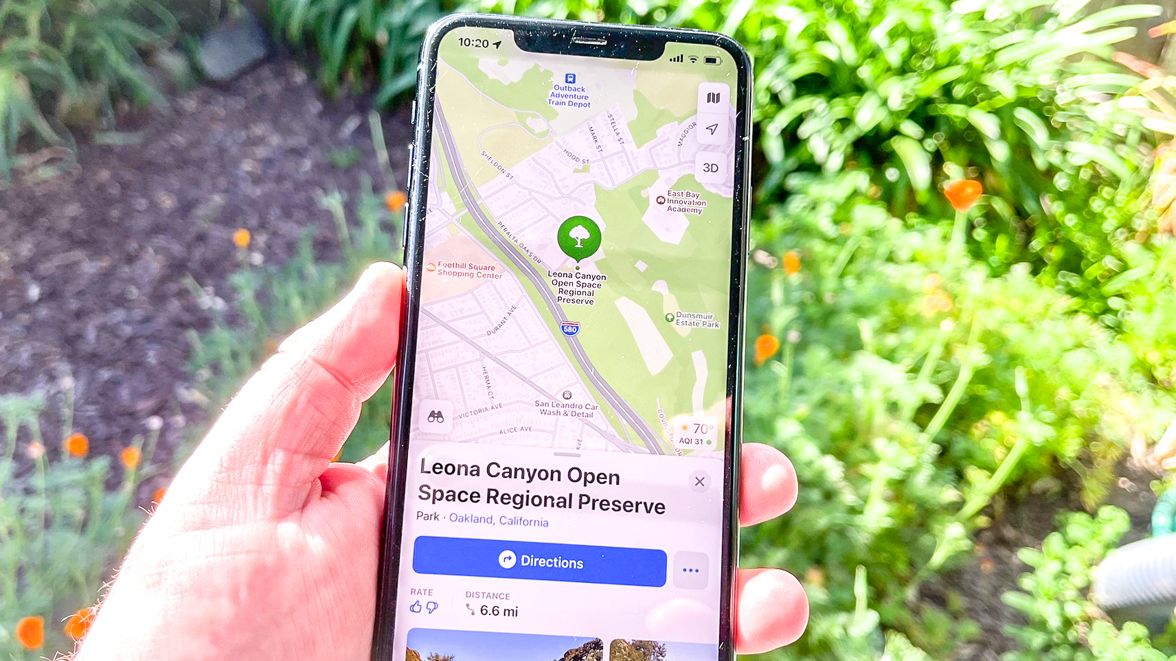
Take last weekend's hike, a lovely stroll through the Leona Canyon Regional Open Space Preserve. That's a little bit more than 13.5 miles from my house, a fairly easy haul. Unfortunately, when I plugged "Leona Canyon Regional Open Space Preserve" into Maps, Apple's software had me drive an extra 1.5 miles to the southeast, sending me instead to the main offices for the regional park district that manages Leona Canyon.
If this were the first time that Apple Maps made my hiking adventures a little bit too adventurous for my taste, I'd chalk it up to a stray instance of bad data. But it's a recurring problem for Apple's mapping software.
One time, searching for a trailhead, Apple Maps directed me to the driveway of a rather perplexed homeowner. Another time, Apple Maps suggested a route to a regional park with trails that sent me on a tortuous path of switchbacks and one-lane roads that had everyone in the car reaching for barf bags, only for us to discover that a slightly longer route would have involved exactly zero twists and turns.
Get instant access to breaking news, the hottest reviews, great deals and helpful tips.
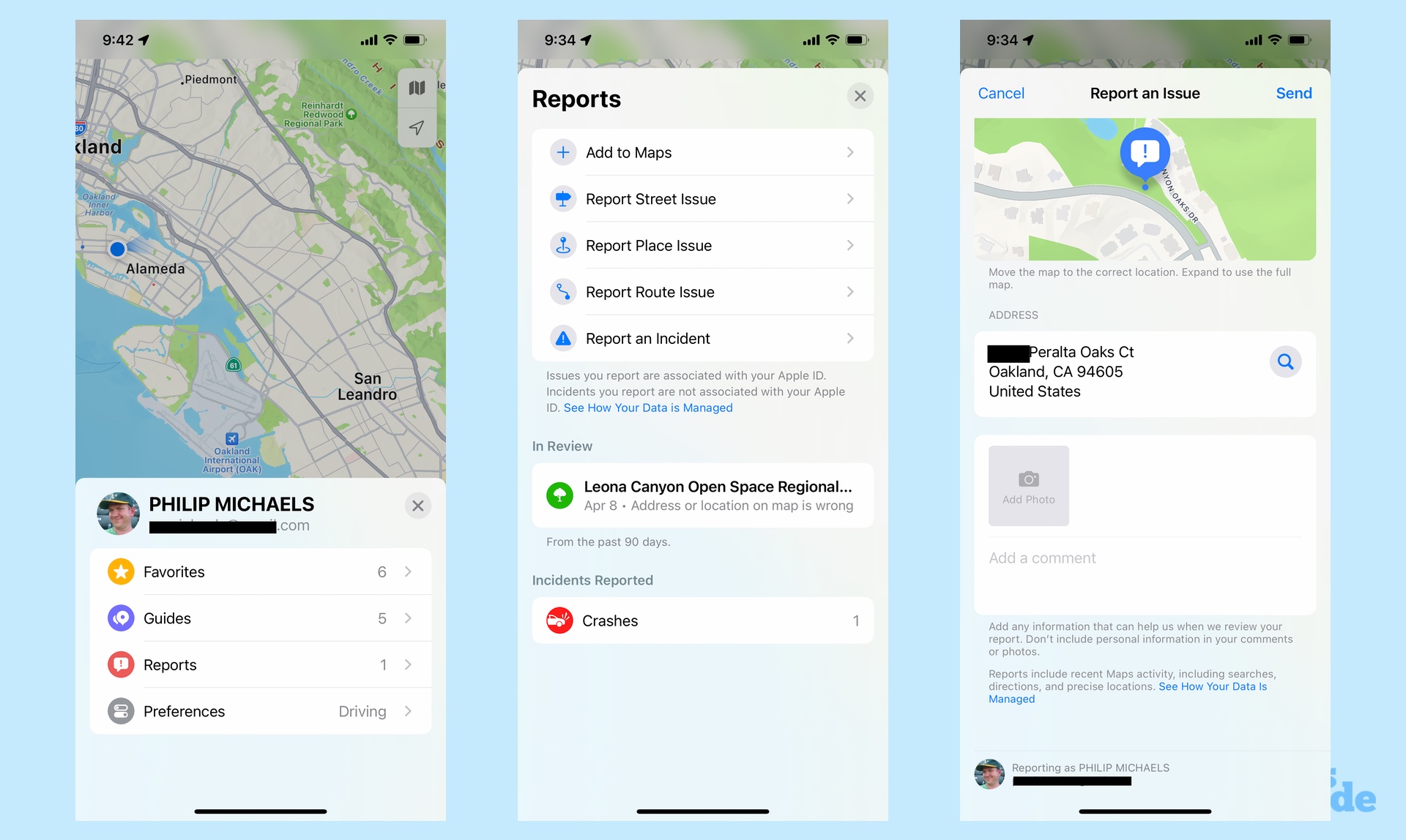
On a side note, did you know that you can report issues with Apple Maps such as — just as an example here — being sent to the entirely wrong place when all you want to do is go for a hike? Just tap your picture next to the search bar in the Maps app, followed by the Reports option. You can then report issues with streets, places or routes that get sent directly to Apple.

To be fair, Apple doesn't make the only mapping software that's hit or miss (and mostly miss) when you want to enjoy the Great Outdoors. Google Maps produces some howlers as well when you ask it to find specific trails. It did manage to properly locate Leona Canyon, for example, though like Apple, it would have sent me to that perplexed homeowners driveway when I wanted to hike in that other regional park.
I'd guess there are a couple different factors at play that prevent mapping software makers from delivering a seamless experience for getting you to the nearest hiking trail. For one thing, it's not as if hiking trails have a mailing address that making them easy to pinpoint on a map. For another, a lot of trailheads aren't usually marked by anything more than a sign by the side of road and maybe a handful of parking spaces if you're lucky.
Those are the sorts of things that can escape the attention of cars driving around collecting data for mapping software — if those vehicles are even spending time in more rural, out-of-the-way locales.
Just because it's hard to get accurate data on trail locations doesn't mean it can't be done.
But just because it's hard to get accurate data on trail locations doesn't mean it can't be done. Look at some of the improvements made by Apple to Maps in iOS 15, such as detailed city views in some areas that call out buildings, commercial districts and landmarks. The driving view shows lanes, medians, crosswalks and other details that help you navigate your way through unfamiliar settings. These are granular details that took a lot of effort to get right; I'd like to see that same effort applied to accurately showing where trails are and how to reach them.
While we're telling Apple how to improve Maps, I wouldn't mind seeing Apple integrate trail maps themselves into its mapping app. Again, this is a tall order, given the sheer volume of hiking trails that are out there. But Apple has managed to incorporate walking directions into Maps that go beyond car-accessible streets — we're talking pathways, lanes and alleys only accessible by foot.
What's more, there are a number of hiking trail apps available for download from the App Store — AllTrails (Android, iOS) is well regarded and one of my colleagues touts Komoot (Android, iOS) — so trail information is clearly out there. Incorporate that into Maps, make the trail maps downloadable (in case you can't get a signal on trail), and you've got a fully functioning mapping tool at your disposal.
Before all that, though, I just want Apple Maps to get me to the trail first. That'd be a big step in the right direction.
Philip Michaels is a Managing Editor at Tom's Guide. He's been covering personal technology since 1999 and was in the building when Steve Jobs showed off the iPhone for the first time. He's been evaluating smartphones since that first iPhone debuted in 2007, and he's been following phone carriers and smartphone plans since 2015. He has strong opinions about Apple, the Oakland Athletics, old movies and proper butchery techniques. Follow him at @PhilipMichaels.
 Club Benefits


