 Club Benefits


Google Maps is about to get a lot more useful, letting you know when it’s best to go outside, and helping you navigate your way indoors, too. This week Google Maps revealed a new set of AR tools that help you get around indoor locations, and much more, including a weather layer and travel routes that are more environmentally friendly.
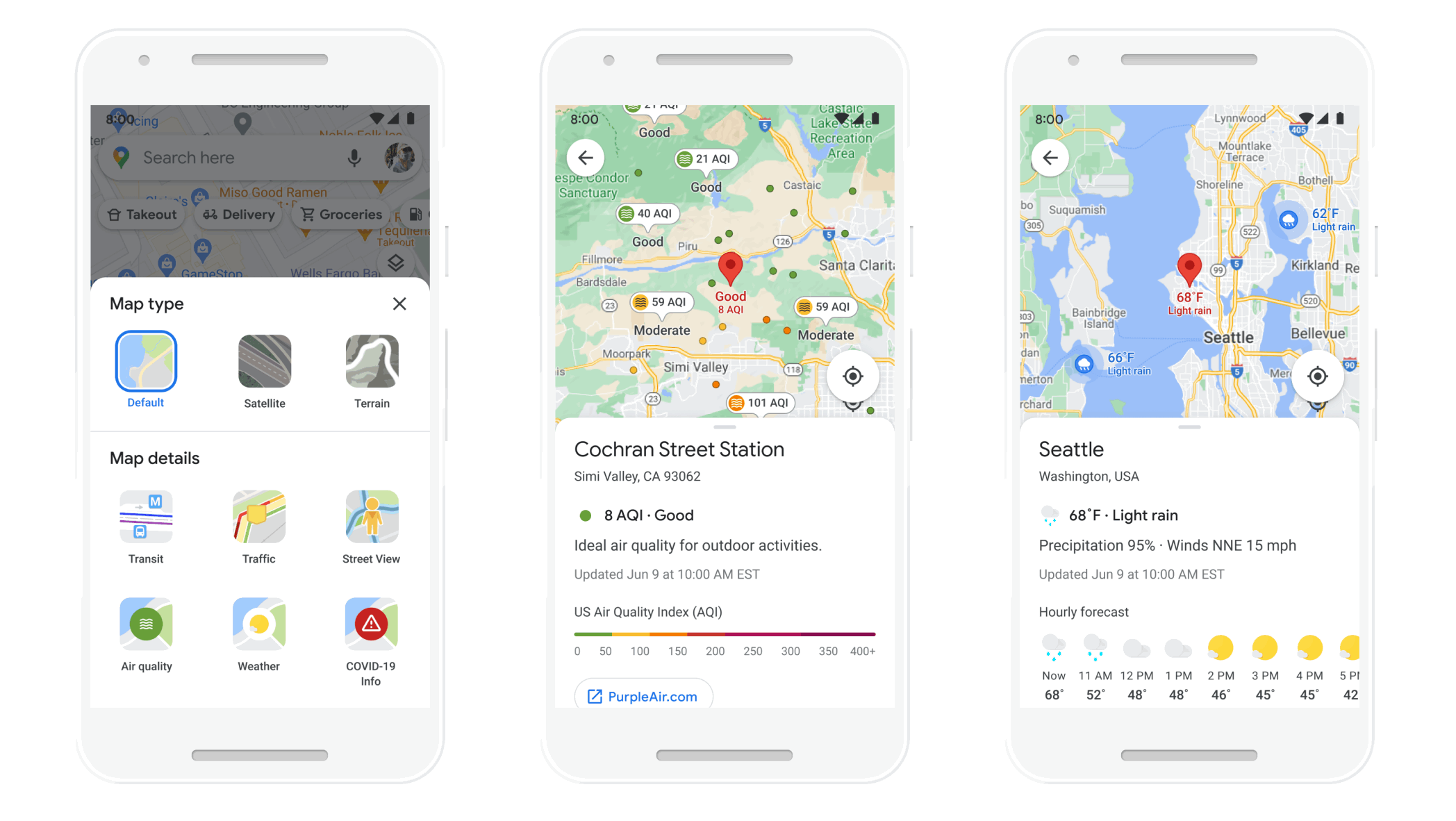
Even before you head out, new Weather and Air Quality layers will let you know what conditions are like, and if you should bring along an umbrella. Google says that the data will come from the Weather Company, AirNow.gov and the Central Pollution Board. While the Weather layer will be available globally, the air quality layer will only be rolled out to the U.S., Australia, and India at launch.
- How to use Google Maps: 20 essential tips and tricks
- Google Maps vs Waze: Which navigation app is better for you?
- Plus: Google Maps now lets you draw in roads — how it works
In an effort to decrease the effects of climate change — and save you on gas — Google Maps will suggest routes that will use the lowest amount of fuel, based on such things as the incline of the road and traffic along the route.
Article continues belowFrom eco-friendly routes to showing weather and air quality layers, @GoogleMaps has an exciting road ahead. Learn how Google Maps is pushing the boundaries of what a map can do → https://t.co/nDx1SJwZXF pic.twitter.com/4ixTzKe7K9March 30, 2021
Google Maps will pick the route with the lowest carbon footprint if the travel time is roughly the same as the fastest route. Users will be able to compare the carbon footprints of various routes, and can change to the fastest route if they choose. This feature will roll out in the U.S. this year, with other countries to follow.
Google Maps will also make it easier to compare alternate forms of transportation, be it by car, bus, train, or bike — and prioritize routes based on your preferences, as well as the preferred mode of travel wherever you happen to be going.
Google Maps will also alert drivers when their route will take them through low emission zones and provide alternate routes if their vehicle is not permitted in that area. This feature will roll out in June in Germany, the Netherlands, France, Spain, and the UK.
Once it’s safe(r) to go back to malls and other indoor spaces, a new Indoor Live View AR will help you find your way inside airports and train stations, which should be especially helpful when traveling through an unfamiliar city. Indoor Live View will give you step-by-step visual directions to locations such as stores, restrooms, ticket offices, ATMs, and baggage claims.
Indoor Live View is now available for certain malls in Chicago, Long Island, Los Angeles, Newark, San Francisco, San Jose, and Seattle. In the coming months, it will roll out in airports, malls, and transit stations in Tokyo and Zurich.
In all, these all look to be very helpful upgrades to Google Maps, and will certainly make getting around labyrinthine subway stations a lot easier. We’re also interested to see if the new routes save us on gas, too.
